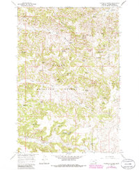
1966 Map of Threemile Buttes
USGS Topo · Published 1986About this map
Custer National Forest dominates the southern half of this landscape, where the terrain transitions from rugged buttes into a network of drainage basins. The area's ranching and homesteading history is evidenced by numerous family-named water sources, such as Knudson Spring, McLennon Spring No 1, and Quebbeman Spring. These water points were critical for livestock in this arid portion of Powder River County, supporting the operations that once centered around landmarks like the Bottles Sch and Phillips Well.
Find a feature on this map
91 named features on this map. Tap any name to fly to it.
Don’t see what you’re looking for? This feature index may not catch every label — zoom into the map to look around manually.
Map Details
Editions of this 1966 Threemile Buttes Map
2 editions found

Other maps of this area

1954 · Hardin
USGS Topo · 1:250,000

1954 · Ekalaka
USGS Topo · 1:250,000

1956 · Ekalaka
USGS Topo · 1:250,000

1957 · Hardin
USGS Topo · 1:250,000

1958 · Ekalaka
USGS Topo · 1:250,000

1958 · Hardin
USGS Topo · 1:250,000

1965 · Ekalaka
USGS Topo · 1:250,000

1966 · Goodspeed Butte
USGS Topo · 1:24,000

1966 · Sonnette
USGS Topo · 1:24,000

1966 · Coleman Draw
USGS Topo · 1:24,000