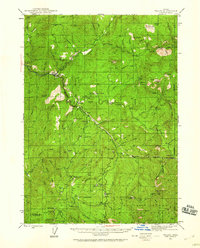
1944 Map of Tiller
USGS Topo · Published 1960About this map
The South Fork Umpqua River carves through a landscape defined by early 20th-century resource extraction and isolated homesteads. The small settlement of Tiller serves as a central hub, supported by the Tiller Ranger Station, while the surrounding timberland is dotted with family operations and mountain camps. Mining activity is prominent in the southern reaches, including the Banfield Mine, Rowley Mine, and Mammoth Lode Mine, which sought minerals in the ridges above Granite Creek.
Find a feature on this map
115 named features on this map. Tap any name to fly to it.
Don’t see what you’re looking for? This feature index may not catch every label — zoom into the map to look around manually.
Map Details
Editions of this 1944 Tiller Map
5 editions found
Other maps of this area

1891 · Ashland
USGS Topo · 1:250,000

1893 · Ashland
USGS Topo · 1:250,000

1897 · Roseburg
USGS Topo · 1:125,000

1897 · Ashland
USGS Topo · 1:250,000

1900 · Roseburg
USGS Topo · 1:125,000

1904 · Riddle
USGS Topo · 1:125,000

1943 · Trail
USGS Topo · 1:62,500

1944 · Tiller
USGS Topo · 1:62,500

1944 · Abbott Butte
USGS Topo · 1:62,500

1947 · Abbott Butte
USGS Topo · 1:62,500