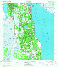
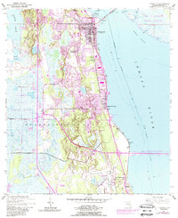
1949 Map of Titusville
USGS Topo · Published 1968About this map
The town of Titusville and its proximity to the Indian River are captured here just before the massive expansion of the nearby space program. This survey shows the area's transition from a citrus-and-river economy to a modern aeronautical hub, evidenced by the presence of the Titusville Airport and the Titusville Cocoa Airport. The landscape is a mix of historic land divisions like the Delespine Grant and developing residential areas such as Whispering Hills Golf Estates.
Find a feature on this map
27 named features on this map. Tap any name to fly to it.
Don’t see what you’re looking for? This feature index may not catch every label — zoom into the map to look around manually.
Map Details
Editions of this 1949 Titusville Map
6 editions found
Other maps of this area

1949 · Orsino
USGS Topo · 1:24,000

1949 · Titusville
USGS Topo · 1:24,000

1949 · Courtenay
USGS Topo · 1:24,000

1949 · Wilson
USGS Topo · 1:24,000

1949 · Mims
USGS Topo · 1:24,000

1949 · Sharpes
USGS Topo · 1:24,000

1950 · Aurantia
USGS Topo · 1:24,000

1951 · Courtenay
USGS Topo · 1:24,000

1951 · Sharpes
USGS Topo · 1:24,000

1951 · Orsino
USGS Topo · 1:24,000
Featured Places
- Titusville, FL
- Whispering Hills Golf Estates, Titusville
- Indian River City, Titusville
- South Titusville, FL
- Bellwood, FL