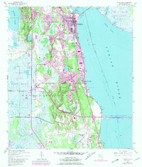
1949 Map of Titusville
USGS Topo · Published 1981About this map
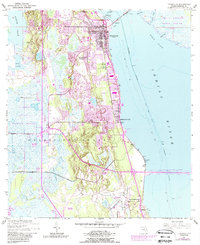
Titusville serves as the focal point of this coastal survey, where the Florida East Coast railway tracks parallel the shoreline of the broad Indian River. The map illustrates a significant period of growth in Brevard County, capturing the transition from the traditional citrus and maritime economy toward the aerospace era. To the east, across the IntraCoastal Waterway, the nascent footprint of the John F Kennedy Space Center (NASA) appears on the Merritt Island side, connected by the NASA Parkway West Causeway.
Find a feature on this map
31 named features on this map. Tap any name to fly to it.
Don’t see what you’re looking for? This feature index may not catch every label — zoom into the map to look around manually.
Map Details
Editions of this 1949 Titusville Map
6 editions found
Other maps of this area

1949 · Orsino
USGS Topo · 1:24,000

1949 · Titusville
USGS Topo · 1:24,000

1949 · Courtenay
USGS Topo · 1:24,000

1949 · Wilson
USGS Topo · 1:24,000

1949 · Mims
USGS Topo · 1:24,000

1949 · Sharpes
USGS Topo · 1:24,000

1950 · Aurantia
USGS Topo · 1:24,000

1951 · Courtenay
USGS Topo · 1:24,000

1951 · Sharpes
USGS Topo · 1:24,000

1951 · Orsino
USGS Topo · 1:24,000
Featured Places
- Titusville, FL
- Whispering Hills Golf Estates, Titusville
- Indian River City, Titusville
- South Titusville, FL
- Bellwood, FL