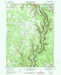
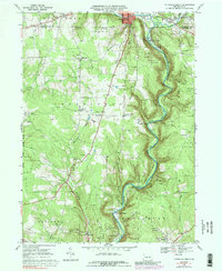
1968 Map of Titusville South
USGS Topo · Published 1989About this map
Oil Creek carves a deep valley through this portion of Venango County, a landscape defined by the legacies of the early petroleum industry. The map captures the specialized geography of the Pennsylvania oil fields, where numerous oil wells dot the hillsides between small settlements like Petroleum Center and Columbia Farm. In the north, Drake Well State Park and a local Museum mark the site of the world's first commercial oil well, grounding the map's industrial data in its significant historical context.
Find a feature on this map
45 named features on this map. Tap any name to fly to it.
Don’t see what you’re looking for? This feature index may not catch every label — zoom into the map to look around manually.
Map Details
Editions of this 1968 Titusville South Map
5 editions found
Other maps of this area

1909 · Franklin
USGS Topo · 1:62,500

1911 · Franklin
USGS Topo · 1:62,500

1922 · Oil City
USGS Topo · 1:48,000

1924 · Oil City
USGS Topo · 1:62,500

1927 · Townville
USGS Topo · 1:48,000

1927 · Titusville
USGS Topo · 1:62,500

1932 · Townville
USGS Topo · 1:62,500

1933 · Titusville
USGS Topo · 1:62,500

1943 · Oil City
USGS Topo · 1:62,500

1945 · Townville
USGS Topo · 1:62,500
Featured Places
- Titusville, PA
- Cherrytree Township, PA
- Cornplanter Township, PA
- Petroleum Center, Cornplanter Township
- East Titusville, PA