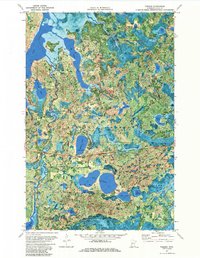
1971 Map of Tobique
USGS Topo · Published 1985About this map
Chippewa National Forest surrounds a complex network of glacial lakes and waterways within Cass County, where the Boy River meanders through the landscape. This 1971 orthophotomap provides a rare hybrid view, combining traditional topographic contour lines with actual aerial photography from 1969. The settlement of Tobique is situated in the north, while the Soo Line railroad cuts across the northeastern corner. In the southern portion of the quadrangle, Inguadona Lake and Twin Lakes dominate the terrain, reflecting the recreational and timber-focused character of the region during this era. Evidence of local infrastructure and resource management is visible through features like the Remer Lookout Tower, a Gravel Pit, and the Mabel Lake Campground, showing the balance between industrial use and public access to the Minnesota wilderness.
Find a feature on this map
32 named features on this map. Tap any name to fly to it.
Don’t see what you’re looking for? This feature index may not catch every label — zoom into the map to look around manually.
Map Details
Editions of this 1971 Tobique Map
3 editions found
Other maps of this area

1953 · Duluth
USGS Topo · 1:250,000

1953 · Brainerd
USGS Topo · 1:250,000

1954 · Bemidji
USGS Topo · 1:250,000

1954 · Hibbing
USGS Topo · 1:250,000

1957 · Brainerd
USGS Topo · 1:250,000

1957 · Bemidji
USGS Topo · 1:250,000

1957 · Hibbing
USGS Topo · 1:250,000

1958 · Bemidji
USGS Topo · 1:250,000

1958 · Hibbing
USGS Topo · 1:250,000

1958 · Brainerd
USGS Topo · 1:250,000