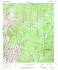
1954 Map of Toro
USGS Topo · Published 1970About this map
Bayou Toro and the Sabine River define this borderland between Louisiana and Texas during a period of significant landscape transformation. The 1969 photorevisions capture the emergence of the Toledo Bend Reservoir, which altered the western terrain along Arnold Creek and submerged old river features like Robinson Bend and Middle Lake. This map document reflects the rural character of Sabine Parish, anchored by the settlement at Toro and a network of community landmarks including Little Flock Church, Victoria Church, and the McMahon Cemetery. A dismantled railroad trace in the northern sections speaks to the waning of earlier industrial eras, even as the Sabine National Forest preserves the wooded interior. The detail captures numerous small waterways such as Yocum Creek and Arthur Creek that fed the river system before the reservoir's full expansion.
Find a feature on this map
40 named features on this map. Tap any name to fly to it.
Don’t see what you’re looking for? This feature index may not catch every label — zoom into the map to look around manually.
Map Details
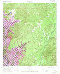
Editions of this 1954 Toro Map
3 editions found

Other maps of this area

1941 · Leesville
USGS Topo · 1:62,500

1942 · Florien
USGS Topo · 1:62,500

1943 · Leesville
USGS Topo · 1:62,500

1944 · Negreet
USGS Topo · 1:62,500

1944 · Wiergate
USGS Topo · 1:62,500

1944 · Florien
USGS Topo · 1:62,500

1946 · Leesville
USGS Topo · 1:62,500

1948 · Leesville
USGS Topo · 1:62,500

1948 · Wiergate
USGS Topo · 1:62,500

1953 · Alexandria
USGS Topo · 1:250,000