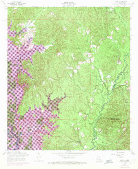
1954 Map of Toro
USGS Topo · Published 1972About this map
The Sabine National Forest anchors this borderland landscape between Louisiana and Texas during a period of significant hydrological change. Photorevised in 1969, the map documents the emergence of the Toledo Bend Reservoir, which altered the drainage patterns of Toro Creek, Blackland Creek, and Yocum Creek. The presence of a Dismantled railroad and Oil Well Lake points to the area's industrial history, while rural community life remains centered around several country churches.
Find a feature on this map
30 named features on this map. Tap any name to fly to it.
Don’t see what you’re looking for? This feature index may not catch every label — zoom into the map to look around manually.
Map Details
Editions of this 1954 Toro Map
3 editions found

Other maps of this area

1941 · Leesville
USGS Topo · 1:62,500

1942 · Florien
USGS Topo · 1:62,500

1943 · Leesville
USGS Topo · 1:62,500

1944 · Negreet
USGS Topo · 1:62,500

1944 · Wiergate
USGS Topo · 1:62,500

1944 · Florien
USGS Topo · 1:62,500

1946 · Leesville
USGS Topo · 1:62,500

1948 · Leesville
USGS Topo · 1:62,500

1948 · Wiergate
USGS Topo · 1:62,500

1953 · Alexandria
USGS Topo · 1:250,000