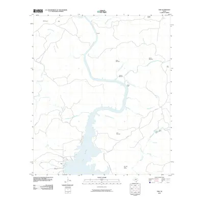
2010 Map of Tow
USGS Topo · Published 2010About this map
Lake Buchanan dominates the southern landscape of this Hill Country quadrangle, where the Colorado River feeds into the reservoir's northern reaches. The settlement of Tow sits along the western shore, anchored by the Tow Cemetery and a network of local roads like Co RD 222. The terrain is defined by prominent elevations such as Indian Mountain, Gray Mountain, and the cliffs at Chism Bluff, illustrating the transition from upland prairies like Buffalo Prairie to the deep river cuts of the Colorado.
Find a feature on this map
44 named features on this map. Tap any name to fly to it.
Don’t see what you’re looking for? This feature index may not catch every label — zoom into the map to look around manually.
Map Details
Editions of this 2010 Tow Map
This is the sole edition of this map. No revisions or reprints were ever made.
Other maps of this area

1885 · San Saba
USGS Topo · 1:125,000

1887 · Llano
USGS Topo · 1:125,000

1887 · Lampasas
USGS Topo · 1:125,000

1887 · Burnet
USGS Topo · 1:125,000

1893 · Burnet
USGS Topo · 1:125,000

1894 · Lampasas
USGS Topo · 1:125,000

1894 · San Saba
USGS Topo · 1:125,000

1894 · Llano
USGS Topo · 1:125,000

1903 · Burnet
USGS Topo · 1:125,000

1904 · Llano
USGS Topo · 1:125,000