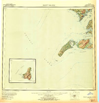
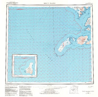
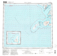
1954 Map of Trinity Islands
USGS Topo · Published 1956About this map
Kodiak Island and its southern maritime reaches are documented here during a period of mid-century coastal surveying. The landscape is defined by the remote settlements of Akhiok and Miller on the mainland, while the Kodiak National Wildlife Refuge encompasses the interior wilderness. Navigational landmarks like Cape Alitak and Cape Trinity guide entry into the deep inlets of Alitak Bay and Moser Bay.
Find a feature on this map
40 named features on this map. Tap any name to fly to it.
Don’t see what you’re looking for? This feature index may not catch every label — zoom into the map to look around manually.
Map Details
Editions of this 1954 Trinity Islands Map
7 editions found

Other maps of this area

1943 · Ugashik
USGS Topo · 1:250,000

1948 · Ugashik
USGS Topo · 1:250,000

1949 · Ugashik
USGS Topo · 1:250,000

1951 · Kaguyak
USGS Topo · 1:250,000

1951 · Trinity Islands
USGS Topo · 1:250,000

1951 · Karluk
USGS Topo · 1:250,000

1951 · Sutwik Island
USGS Topo · 1:250,000

1952 · Kodiak
USGS Topo · 1:250,000

1952 · Kaguyak
USGS Topo · 1:250,000

1952 · Karluk
USGS Topo · 1:250,000