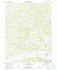
1962 Map of Trinway
USGS Topo · Published 1991About this map
The Pennsylvania railroad corridor anchors this survey of the boundary between Muskingum and Coshocton Counties, where the landscape transitions from the broad floodplains of the Muskingum River to the dissected hills of The Highlands. The settlement of Trinway serves as a local rail hub, situated near the confluence of Wakatomika Creek and the river, while Dresden sits just to the south. The rural interior is defined by a series of named ridges, including Graham Ridge and Irish Ridge, which are dotted with evidence of the region's extraction economy, from numerous Oil Wells and Gas Wells to northern Strip Mines.
Find a feature on this map
45 named features on this map. Tap any name to fly to it.
Don’t see what you’re looking for? This feature index may not catch every label — zoom into the map to look around manually.
Map Details
Editions of this 1962 Trinway Map
4 editions found
Other maps of this area

1908 · Conesville
USGS Topo · 1:62,500

1910 · Frazeysburg
USGS Topo · 1:62,500

1910 · Conesville
USGS Topo · 1:62,500

1913 · Brinkhaven
USGS Topo · 1:62,500

1913 · Coshocton
USGS Topo · 1:62,500

1915 · Brinkhaven
USGS Topo · 1:62,500

1915 · Coshocton
USGS Topo · 1:62,500

1943 · Coshocton
USGS Topo · 1:62,500

1950 · Marion
USGS Topo · 1:250,000

1951 · Canton
USGS Topo · 1:250,000