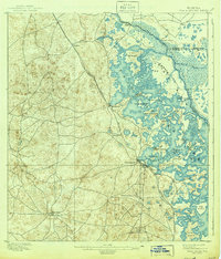
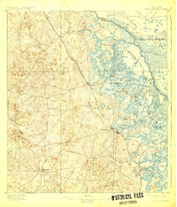
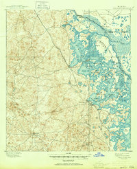
1895 Map of Tsala Apopka
USGS Topo · Published 1944About this map
Inverness serves as a central hub on the western shore of Henderson Lake, situated at the convergence of significant regional transport lines during the 1890s. The landscape is dominated by the sprawling, intricate network of Tsala Apopka Lake and the Withlacoochee River, where numerous named islands like Gospel Island and Big Island suggest a community deeply tied to the water. The presence of the Savannah Florida and Western R. R. and the South Florida Div. railroads highlights the era's expanding connectivity, linking settlements such as Hernando, Arlington, and Mannfield. Local industry is evidenced by the Hamburg Mine, while the mention of Stokes Ferry and Morrison Landing points to established river crossings and trade points along the Marion and Citrus county boundary.
Find a feature on this map
34 named features on this map. Tap any name to fly to it.
Don’t see what you’re looking for? This feature index may not catch every label — zoom into the map to look around manually.
Map Details
Editions of this 1895 Tsala Apopka Map
7 editions found
Other maps of this area

1892 · Dunnellon
USGS Topo · 1:62,500

1893 · Panasoffkee
USGS Topo · 1:62,500

1894 · Dunnellon
USGS Topo · 1:62,500

1895 · Tsala Apopka
USGS Topo · 1:62,500

1895 · Panasoffkee
USGS Topo · 1:62,500

1895 · Ocala
USGS Topo · 1:62,500

1954 · Lecanto
USGS Topo · 1:24,000

1954 · Homosassa
USGS Topo · 1:24,000

1954 · Holder
USGS Topo · 1:24,000

1954 · Crystal River
USGS Topo · 1:24,000