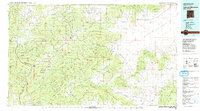
1983 Map of Tularosa Mountains
USGS Topo · Published 1983About this map
Reserve serves as a central hub in this high-altitude landscape, situated where the San Francisco River meets the drainages of the Tularosa Mountains. This 1983 edition illustrates a region defined by the administrative overlap of the Apache National Forest and Gila National Forest, capturing a network of small settlements and isolated landmarks. The map tracks the passage of the Continental Divide across the eastern terrain, where the mountains give way to the Plains of San Agustin.
Find a feature on this map
51 named features on this map. Tap any name to fly to it.
Don’t see what you’re looking for? This feature index may not catch every label — zoom into the map to look around manually.
Map Details
Editions of this 1983 Tularosa Mountains Map
2 editions found
Other maps of this area

1886 · St Johns
USGS Topo · 1:250,000

1892 · St Johns
USGS Topo · 1:250,000

1910 · Mogollon
USGS Topo · 1:125,000

1911 · Alum Mountain
USGS Topo · 1:125,000

1912 · Mogollon
USGS Topo · 1:125,000

1913 · Alum Mountain
USGS Topo · 1:125,000

1913 · Morenci
USGS Topo · 1:125,000

1915 · Morenci
USGS Topo · 1:125,000

1915 · Reserve
USGS Topo · 1:125,000

1918 · Pelona
USGS Topo · 1:125,000