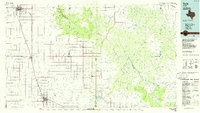
1985 Map of Tulia
USGS Topo · Published 1994About this map
The dramatic rift of Palo Duro Canyon State Park dominates the northeastern landscape of this mid-1980s survey. The Dog Town Fork Red River carves through the High Plains, flanked by prominent landmarks like Goodnight Peak, Devils Tombstone, and Fortress Cliff. To the west, the flat tableland is defined by the agricultural and educational hub of Canyon, home to West Texas State Univ, and the county seat of Tulia further south.
Find a feature on this map
122 named features on this map. Tap any name to fly to it.
Don’t see what you’re looking for? This feature index may not catch every label — zoom into the map to look around manually.
Map Details
Editions of this 1985 Tulia Map
2 editions found
Other maps of this area

1954 · Tucumcari
USGS Topo · 1:250,000

1954 · Amarillo
USGS Topo · 1:250,000

1954 · Plainview
USGS Topo · 1:250,000

1954 · Clovis
USGS Topo · 1:250,000

1956 · Fortress Cliff
USGS Topo · 1:24,000

1956 · Thomas Ranch
USGS Topo · 1:24,000

1958 · Clovis
USGS Topo · 1:250,000

1958 · Amarillo
USGS Topo · 1:250,000

1958 · Tucumcari
USGS Topo · 1:250,000

1958 · Plainview
USGS Topo · 1:250,000