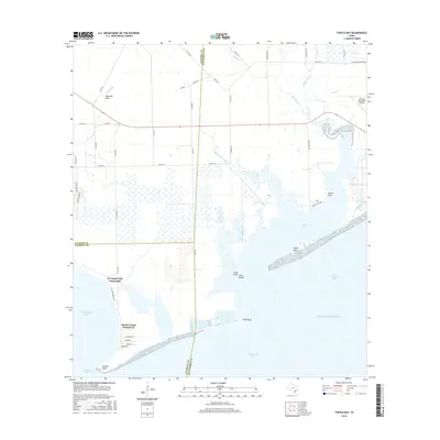
2016 Map of Turtle Bay
USGS Topo · Published 2016About this map
Turtle Bay and its connection to Matagorda Bay define this coastal landscape on the Texas Gulf Coast. Small residential developments like the El Campo Club Community and Schicke Point Community are situated along the shoreline, illustrating the region's mid-century and later shift toward recreational waterfront living. The map captures a complex system of estuaries where Carancahua Bay and Tres Palacios Bay meet the open waters of the Gulf of Mexico.
Find a feature on this map
58 named features on this map. Tap any name to fly to it.
Don’t see what you’re looking for? This feature index may not catch every label — zoom into the map to look around manually.
Map Details
Editions of this 2016 Turtle Bay Map
This is the sole edition of this map. No revisions or reprints were ever made.
Other maps of this area

1951 · Keller Bay
USGS Topo · 1:24,000

1952 · Palacios Point
USGS Topo · 1:24,000

1952 · Palacios
USGS Topo · 1:24,000

1952 · Olivia
USGS Topo · 1:24,000

1952 · Turtle Bay
USGS Topo · 1:24,000

1952 · Francitas
USGS Topo · 1:24,000

1952 · Blessing
USGS Topo · 1:24,000

1952 · La Ward
USGS Topo · 1:24,000

1953 · Beeville
USGS Topo · 1:250,000

1956 · Beeville
USGS Topo · 1:250,000
Featured Places
- Palacios, TX
- El Campo Club Community, TX
- Schicke Point Community, TX
- Matagorda County, TX
- Calhoun County, TX