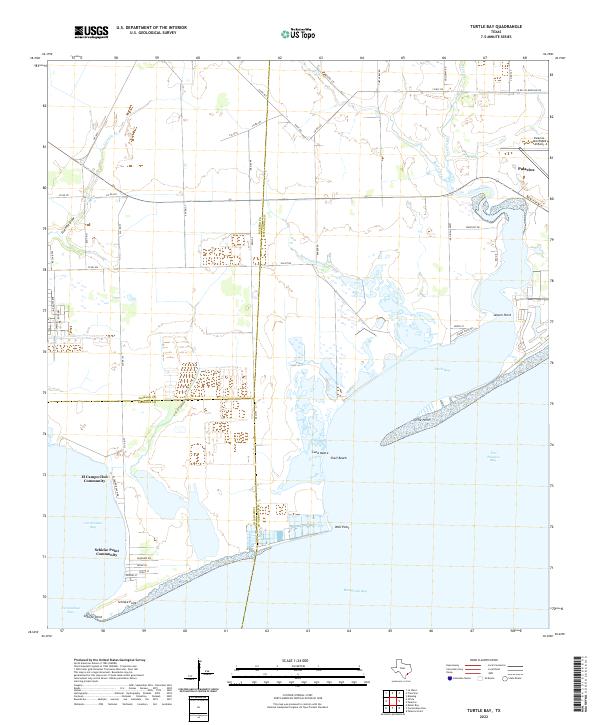
2022 Map of Turtle Bay
USGS Topo · Published 2022About this map
Turtle Bay and the surrounding coastal wetlands of the Texas Gulf Coast are defined by a complex network of bays and secondary inlets. The landscape is characterized by its tidal hydrology, where Buttermilk Slough drains into the bay system and Turtle Creek winds through the coastal prairie. Human settlement is concentrated along the shorelines and higher ground, notably in the town of Palacios near the Palacios Municipal Airport. Smaller residential enclaves like the El Campo Club Community and Schicke Point Community are positioned at the water's edge, highlighting the area's recreational and maritime orientation. The map also delineates the meeting of three counties—Jackson, Matagorda, and Calhoun—across open water and low-lying landforms such as Lund Motte and Shell Beach, providing a clear record of administrative boundaries and coastal geography in the early twenty-first century.
Find a feature on this map
62 named features on this map. Tap any name to fly to it.
Don’t see what you’re looking for? This feature index may not catch every label — zoom into the map to look around manually.
Map Details
Editions of this 2022 Turtle Bay Map
This is the sole edition of this map. No revisions or reprints were ever made.
Other maps of this area

1951 · Keller Bay
USGS Topo · 1:24,000

1952 · Palacios Point
USGS Topo · 1:24,000

1952 · Palacios
USGS Topo · 1:24,000

1952 · Olivia
USGS Topo · 1:24,000

1952 · Turtle Bay
USGS Topo · 1:24,000

1952 · Francitas
USGS Topo · 1:24,000

1952 · Blessing
USGS Topo · 1:24,000

1952 · La Ward
USGS Topo · 1:24,000

1953 · Beeville
USGS Topo · 1:250,000

1956 · Beeville
USGS Topo · 1:250,000
Featured Places
- Palacios, TX
- El Campo Club Community, TX
- Schicke Point Community, TX
- Matagorda County, TX
- Calhoun County, TX