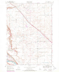
1949 Map of Tuttle
USGS Topo · Published 1978About this map
The Big Wood River and Snake River define this corner of the Snake River Plain, where the basalt landscape is deeply carved by water. The settlement of Tuttle sits at the junction of the Union Pacific railroad and a network of Irrigation Ditches, reflecting the mid-century agricultural development of Gooding County. To the south, the dramatic canyon of the Malad Gorge drops toward the Snake River, flanked by steep descents like Johnson Grade and Vader Grade. This 1949 topography highlights a unique concentration of aquatic resources, from the natural flow of Big Springs and Tucker Springs to the industrial presence of the State Fish Hatchery and Game Reserve. Further downstream near Gridley, the U S Fish Hatchery utilizes the spring-fed waters of Riley Creek, illustrating the early importance of Idaho's cold-water spring systems to state and federal conservation efforts.
Find a feature on this map
20 named features on this map. Tap any name to fly to it.
Don’t see what you’re looking for? This feature index may not catch every label — zoom into the map to look around manually.
Map Details
Editions of this 1949 Tuttle Map
3 editions found
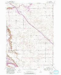
Other maps of this area

1949 · Bliss
USGS Topo · 1:24,000

1949 · Thousand Springs
USGS Topo · 1:24,000

1949 · Gooding Butte
USGS Topo · 1:24,000

1949 · Tuttle
USGS Topo · 1:24,000

1949 · Hagerman
USGS Topo · 1:24,000

1950 · Gooding Butte
USGS Topo · 1:24,000

1950 · Hagerman
USGS Topo · 1:24,000

1950 · Bliss
USGS Topo · 1:24,000

1950 · Niagara Springs
USGS Topo · 1:24,000

1950 · Jerome
USGS Topo · 1:62,500