
2012 Map of Two B Ranch
USGS Topo · Published 2012About this map
Two B Ranch is the namesake of this West Texas landscape in Yoakum County, where the high plains are partitioned into a systematic grid of ranch roads and county thoroughfares. The topography is characterized by subtle elevation changes and the organized geometry of rural land division typical of the Llano Estacado. Movement across the terrain is defined by a network of intersecting routes, including the primary north-south corridor of Ranch Road 2196 and the southern boundary marked by Cherkee Strip Rd. Local connectivity relies on a numbered system of county roads such as Co Rd-120 and Co Rd-150, which facilitate transit between large agricultural and ranching parcels. This 2012 survey by the U.S. Geological Survey illustrates a modern era of land management where traditional ranching operations utilize a highly structured transportation network to navigate the open country.
Find a feature on this map
10 named features on this map. Tap any name to fly to it.
Don’t see what you’re looking for? This feature index may not catch every label — zoom into the map to look around manually.
Map Details
Editions of this 2012 Two B Ranch Map
This is the sole edition of this map. No revisions or reprints were ever made.
Other maps of this area

1954 · Brownfield
USGS Topo · 1:250,000

1958 · Brownfield
USGS Topo · 1:250,000

1962 · Brownfield
USGS Topo · 1:250,000
1970 · Plains 1 SW
USGS Topo · 1:24,000
1970 · Tokio NW
USGS Topo · 1:24,000
1970 · Plains 1 NW
USGS Topo · 1:24,000
1971 · Plains NW
USGS Topo · 1:24,000
1971 · Schooler Ranch
USGS Topo · 1:24,000
1971 · Plains
USGS Topo · 1:24,000
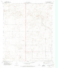
1971 · Two B Ranch
USGS Topo · 1:24,000