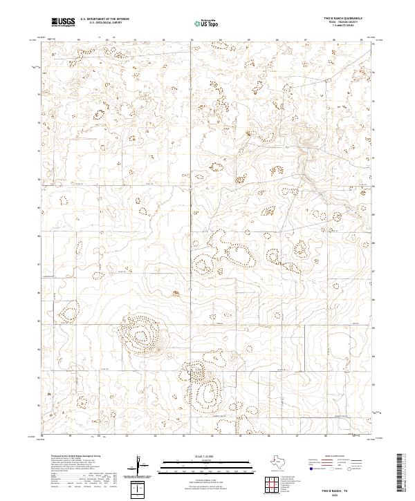
2022 Map of Two B Ranch
USGS Topo · Published 2022About this map
Lost Draw meanders through this section of the Llano Estacado, defining the sparse natural drainage of the West Texas High Plains. The landscape is primarily organized by a rigid grid of rural thoroughfares such as Cherokee Strip Rd and Six Mile Rd, which reflect the region's late-twentieth-century agricultural and ranching development. This 2022 survey captures the modern road network, including State Highway 214, which serves as a primary north-south artery through the ranch lands of Yoakum County. The lack of traditional town centers highlights the decentralized nature of the modern cattle and oil economies, where land is measured in expansive sections connected by long, straight gravel and paved paths like Carpenter Rd and Todd Rd.
Find a feature on this map
14 named features on this map. Tap any name to fly to it.
Don’t see what you’re looking for? This feature index may not catch every label — zoom into the map to look around manually.
Map Details
Editions of this 2022 Two B Ranch Map
This is the sole edition of this map. No revisions or reprints were ever made.
Other maps of this area

1954 · Brownfield
USGS Topo · 1:250,000

1958 · Brownfield
USGS Topo · 1:250,000

1962 · Brownfield
USGS Topo · 1:250,000

1970 · Plains 1 SW
USGS Topo · 1:24,000

1970 · Tokio NW
USGS Topo · 1:24,000

1970 · Plains 1 NW
USGS Topo · 1:24,000

1971 · Plains NW
USGS Topo · 1:24,000

1971 · Schooler Ranch
USGS Topo · 1:24,000
1971 · Plains
USGS Topo · 1:24,000
1971 · Two B Ranch
USGS Topo · 1:24,000