
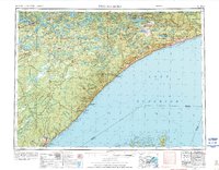
1954 Map of Two Harbors
USGS Topo · Published 1964About this map
Lake Superior dominates the eastern half of this mid-century survey, its coastline marked by the industrial and maritime hubs of Two Harbors and Grand Marais. The inland terrain is characterized by the dense wilderness of the Superior National Forest, where the complex hydrology of Birch Lake, White Iron Lake, and Snowbank Lake defines the landscape. The northern reaches toward Ely and Section Thirty highlight the region's mining and logging roots, connected to the coast by the Duluth Missabe and Iron Range railroad and specialized routes like the Mining Railroad.
Find a feature on this map
78 named features on this map. Tap any name to fly to it.
Don’t see what you’re looking for? This feature index may not catch every label — zoom into the map to look around manually.
Map Details
Editions of this 1954 Two Harbors Map
2 editions found
Other maps of this area

1895 · Duluth
USGS Topo · 1:62,500

1919 · Brule Lake
USGS Topo · 1:62,500

1919 · Grand Marais
USGS Topo · 1:62,500

1919 · Lutsen
USGS Topo · 1:62,500

1933 · Ely
USGS Topo · 1:62,500

1939 · Ely
USGS Topo · 1:62,500

1941 · Bayfield
USGS Topo · 1:48,000

1943 · Port Wing
USGS Topo · 1:48,000

1944 · Cornucopia
USGS Topo · 1:48,000

1946 · Cornucopia
USGS Topo · 1:48,000