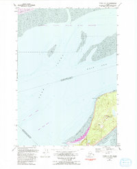
1979 Map of Tyonek A-1 NW
USGS Topo · Published 1993About this map
Fire Island sits at the strategic convergence of the Alaskan coast where the waters of the Cook Inlet split into the Knik Arm and Turnagain Arm. This 1979 survey, updated in the early 1990s, documents the maritime environment and low-lying topography of the Susitna Flats to the north, much of which is protected within the Susitna Flats State Game Refuge. The island itself is marked by technical infrastructure including a Radio Facility and a Heliport, reflecting its role in regional communications and aviation near Anchorage. The shifting nature of the glacial silt and tides is evident in the expansive Fire Island Shoal and West Point Shoal, which create a complex navigation environment around Shelter Bay.
Find a feature on this map
16 named features on this map. Tap any name to fly to it.
Don’t see what you’re looking for? This feature index may not catch every label — zoom into the map to look around manually.
Map Details
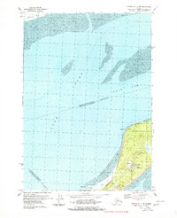
Editions of this 1979 Tyonek A-1 NW Map
2 editions found
Other maps of this area

1949 · Tyonek
USGS Topo · 1:250,000

1951 · Tyonek
USGS Topo · 1:250,000

1951 · Tyonek A-2
USGS Topo · 1:63,360

1951 · Tyonek A-1
USGS Topo · 1:63,360

1952 · Tyonek A-2
USGS Topo · 1:63,360

1952 · Tyonek A-1
USGS Topo · 1:63,360

1958 · Tyonek B-1
USGS Topo · 1:63,360

1958 · Tyonek B-2
USGS Topo · 1:63,360

1958 · Tyonek
USGS Topo · 1:250,000

1965 · Tyonek
USGS Topo · 1:250,000