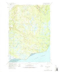
1958 Map of Tyonek A-4
USGS Topo · Published 1967About this map
Tyonek and Old Tyonek anchor this 1958 survey along the northwestern coast of Cook Inlet, reflecting a landscape of seasonal mobility and coastal subsistence. The transition from Old Tyonek to the newer settlement is marked by a network of waterways including Old Tyonek Creek and Tyonek Creek, with the ruins of Tobona appearing nearby. This era shows early infrastructure development in the territory, including a Landing Strip and a coastal Winter Trail leading toward Nikolai Creek. Inland, the map documents a complex system of glacial and muskeg lakes such as Kaldachabuna Lake and Chuitbuna Lake, while the Beluga River and Chuitna River flow through the lowlands east of Lone Ridge. These water systems, combined with labeled features like Chuit Flats, illustrate a geography where river travel and winter trekking were primary means of navigation through the marshy terrain.
Find a feature on this map
36 named features on this map. Tap any name to fly to it.
Don’t see what you’re looking for? This feature index may not catch every label — zoom into the map to look around manually.
Map Details
Editions of this 1958 Tyonek A-4 Map
3 editions found

Other maps of this area

1944 · Kenai
USGS Topo · 1:250,000

1949 · Tyonek
USGS Topo · 1:250,000

1950 · Kenai
USGS Topo · 1:250,000

1950 · Kenai D-4
USGS Topo · 1:63,360

1951 · Tyonek
USGS Topo · 1:250,000

1951 · Kenai D-3
USGS Topo · 1:63,360

1952 · Kenai D-3
USGS Topo · 1:63,360

1952 · Kenai D-4
USGS Topo · 1:63,360

1954 · Tyonek B-4
USGS Topo · 1:63,360

1958 · Tyonek A-5
USGS Topo · 1:63,360