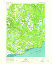
1958 Map of Tyonek A-4
USGS Topo · Published 1967About this map
The Moquawkie (Tyonek) Indian Reservation dominates this mid-century survey of the western shores of Cook Inlet. The map documents the coastal community of Tyonek alongside the site of Old Tyonek, showing the intricate relationship between the Dena'ina people and the varied landscape of Beshta Bay and Trading Bay. A complex network of inland waters, including Congahbuna Lake and Chuitbuna Lake, feeds the prominent Chuitna River as it winds toward the inlet. Evidence of early habitations and transit is visible in the presence of Tobona (Ruins) and the long Winter Trail cutting through the western lowlands. The geography is characterized by dramatic shifts from the tidal flats of Orbit Flats and Granite Pt to the elevated northern terrain of Lone Ridge.
Find a feature on this map
40 named features on this map. Tap any name to fly to it.
Don’t see what you’re looking for? This feature index may not catch every label — zoom into the map to look around manually.
Map Details
Editions of this 1958 Tyonek A-4 Map
3 editions found

Other maps of this area

1944 · Kenai
USGS Topo · 1:250,000

1949 · Tyonek
USGS Topo · 1:250,000

1950 · Kenai
USGS Topo · 1:250,000

1950 · Kenai D-4
USGS Topo · 1:63,360

1951 · Tyonek
USGS Topo · 1:250,000

1951 · Kenai D-3
USGS Topo · 1:63,360

1952 · Kenai D-3
USGS Topo · 1:63,360

1952 · Kenai D-4
USGS Topo · 1:63,360

1954 · Tyonek B-4
USGS Topo · 1:63,360

1958 · Tyonek A-5
USGS Topo · 1:63,360