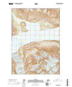
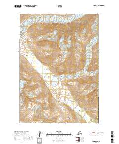
2017 Map of Tyonek A-8 NE
USGS Topo · Published 2017About this map
Ch'akajabena Lake dominates the central portion of this Kenai Peninsula region, serving as a significant glacial catchment fed by the high-elevation meltwater of the Shamrock Glacier. The map illustrates a dramatic Alaskan transition from the ice-carved heights of the glacier down to the Shamrock Lake basin and the Chilligan River corridor. This 2017 survey details a landscape defined by sharp topographic relief and massive hydrological systems, where the absence of roads or permanent settlements highlights the wilderness character of the western Kenai Peninsula Borough. The drainage patterns from the glacier through the lakes and into the river systems provide clear evidence of the active geological forces shaping this remote portion of the Tyonek quadrangle.
Find a feature on this map
9 named features on this map. Tap any name to fly to it.
Don’t see what you’re looking for? This feature index may not catch every label — zoom into the map to look around manually.
Map Details
Editions of this 2017 Tyonek A-8 NE Map
This is the sole edition of this map. No revisions or reprints were ever made.
Other maps of this area

1949 · Tyonek
USGS Topo · 1:250,000

1951 · Tyonek
USGS Topo · 1:250,000

1958 · Tyonek B-8
USGS Topo · 1:63,360

1958 · Tyonek
USGS Topo · 1:250,000

1958 · Tyonek A-8
USGS Topo · 1:63,360
1958 · Tyonek B-7
USGS Topo · 1:63,360
1958 · Tyonek A-7
USGS Topo · 1:63,360

1965 · Tyonek
USGS Topo · 1:250,000
2017 · Tyonek A-7 SW
USGS Topo · 1:25,000
2017 · Tyonek B-7 SW
USGS Topo · 1:25,000