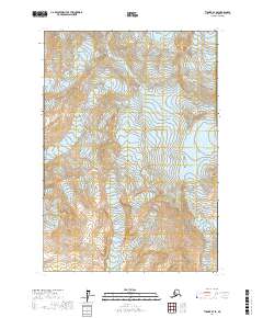
2017 Map of Tyonek B-7 SE
USGS Topo · Published 2017About this map
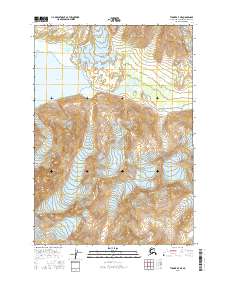
Mt Spurr dominates the landscape of this Kenai Peninsula region, its massive volcanic form surrounded by a complex network of moving ice. The 2017 survey by the U.S. Geological Survey details the high-elevation glacial environment where Pothole Glacier and Capps Glacier originate from the steep slopes of the Tordrillo Mountains. To the south, Barrier Glacier and Crater Glacier illustrate the dynamic ice formations that define this unpopulated wilderness. The map provides a precise look at the township and range boundaries, such as t15n r18w and t14n r17w, tracing the high-altitude contours and drainage patterns that feed into the lower basins. The elevation data reveals the stark prominence of Mt Chichantna, a significant landmark for navigating this remote Alaskan terrain.
Find a feature on this map
12 named features on this map. Tap any name to fly to it.
Don’t see what you’re looking for? This feature index may not catch every label — zoom into the map to look around manually.
Map Details
Editions of this 2017 Tyonek B-7 SE Map
This is the sole edition of this map. No revisions or reprints were ever made.
Other maps of this area

1949 · Tyonek
USGS Topo · 1:250,000

1951 · Tyonek
USGS Topo · 1:250,000

1958 · Tyonek A-6
USGS Topo · 1:63,360

1958 · Tyonek B-6
USGS Topo · 1:63,360

1958 · Tyonek
USGS Topo · 1:250,000
1958 · Tyonek B-7
USGS Topo · 1:63,360
1958 · Tyonek A-7
USGS Topo · 1:63,360
1959 · Tyonek A-6
USGS Topo · 1:63,360

1965 · Tyonek
USGS Topo · 1:250,000
2016 · Tyonek A-7 NE
USGS Topo · 1:25,000