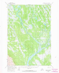
1958 Map of Tyonek C-2
USGS Topo · Published 1967About this map
Susitna sits at the confluence of glacial waters in this mid-century Alaskan survey, serving as a focal point for activity along the Susitna River. The landscape is defined by its complex hydrology, where the braided Yentna River and Kroto Slough carve through the basin. Evidence of seasonal transport and remote habitation is clear, from the Winter Landing Strip to various Cabin and Cabins locations scattered along the banks of Alexander Creek and Fish Creek. A Cem near the river indicates the established nature of the settlement at Susitna. Several triangulation stations, including VABM Sitna 151 and VABM Ander 471, provide precise landmarks across the low-lying terrain and prominent Ridge features.
Find a feature on this map
25 named features on this map. Tap any name to fly to it.
Don’t see what you’re looking for? This feature index may not catch every label — zoom into the map to look around manually.
Map Details
Editions of this 1958 Tyonek C-2 Map
3 editions found
Other maps of this area

1949 · Tyonek
USGS Topo · 1:250,000

1951 · Tyonek
USGS Topo · 1:250,000

1952 · Tyonek D-1
USGS Topo · 1:63,360

1952 · Tyonek C-1
USGS Topo · 1:63,360

1954 · Tyonek D-2
USGS Topo · 1:63,360

1954 · Tyonek D-3
USGS Topo · 1:63,360

1954 · Tyonek D-1
USGS Topo · 1:63,360

1954 · Tyonek C-3
USGS Topo · 1:63,360

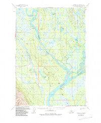
1958 · Tyonek C-2
USGS Topo · 1:63,360

1958 · Tyonek B-1
USGS Topo · 1:63,360