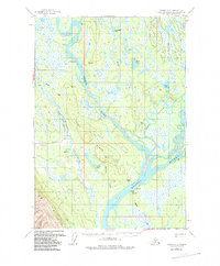
1958 Map of Tyonek C-2
USGS Topo · Published 1985About this map
Susitna sits at the confluence of the Yentna River and the Susitna River, serving as a focal point for this 1950s interior landscape. The historical significance of the region is anchored by the Iditarod Trail, which snakes across the western terrain, passing near several isolated cabins and a Winter Landing Strip. This riverine network, dominated by the broad channels of Kroto Slough and Fish Creek, shows a reliance on water and trail transport before modern road development. The presence of a cemetery and gaging stations near the settlement of Susitna points to a long-standing human footprint in a region defined by seasonal access and shifting glacial waters. Local landmarks like Ladyslipper Lake and Yensus Lake are interspersed among unnamed marshlands, illustrating the complex hydrology of the Matanuska-Susitna area.
Find a feature on this map
34 named features on this map. Tap any name to fly to it.
Don’t see what you’re looking for? This feature index may not catch every label — zoom into the map to look around manually.
Map Details
Editions of this 1958 Tyonek C-2 Map
3 editions found
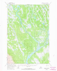
Other maps of this area

1949 · Tyonek
USGS Topo · 1:250,000

1951 · Tyonek
USGS Topo · 1:250,000

1952 · Tyonek D-1
USGS Topo · 1:63,360

1952 · Tyonek C-1
USGS Topo · 1:63,360

1954 · Tyonek D-2
USGS Topo · 1:63,360

1954 · Tyonek D-3
USGS Topo · 1:63,360

1954 · Tyonek D-1
USGS Topo · 1:63,360

1954 · Tyonek C-3
USGS Topo · 1:63,360

1958 · Tyonek C-2
USGS Topo · 1:63,360

1958 · Tyonek B-1
USGS Topo · 1:63,360