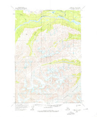
1958 Map of Tyonek D-7
USGS Topo · Published 1976About this map
The Skwentna River and the massive Hayes Glacier dominate this interior landscape, illustrating the transition from ice-carved alpine heights to the broad river valleys of the Matanuska-Susitna region. Recorded through photogrammetric methods in the late 1950s, the terrain shows a clear logistical corridor marked by the Old Winter Trail, which winds past Shirley Lake and various Cabins. These features suggest a seasonal pattern of movement through the territory, where the frozen river and established trails provided the primary means of traversal. Local geography is further defined by Alger Peak and the branching waters of Portage Creek and Chickak River. The southern portion of the map is particularly focused on the glaciated high country, where numerous crevasses are identified across the ice fields feeding into Old Man Creek and Spring Creek.
Find a feature on this map
13 named features on this map. Tap any name to fly to it.
Don’t see what you’re looking for? This feature index may not catch every label — zoom into the map to look around manually.
Map Details
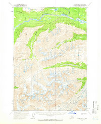
Editions of this 1958 Tyonek D-7 Map
2 editions found
Other maps of this area

1949 · Tyonek
USGS Topo · 1:250,000

1950 · Talkeetna
USGS Topo · 1:250,000

1951 · Talkeetna
USGS Topo · 1:250,000

1951 · Tyonek
USGS Topo · 1:250,000

1958 · Talkeetna A-6
USGS Topo · 1:63,360

1958 · Tyonek C-6
USGS Topo · 1:63,360

1958 · Tyonek D-6
USGS Topo · 1:63,360

1958 · Talkeetna A-5
USGS Topo · 1:63,360

1958 · Tyonek C-8
USGS Topo · 1:63,360

1958 · Tyonek D-8
USGS Topo · 1:63,360