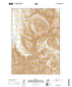
2019 Map of Ugashik A-4 SW
USGS Topo · Published 2019About this map
The Yantarni Volcano dominates the southeastern quadrant of this terrain, its glacial ice and steep slopes characteristic of the volcanic activity found along the Aleutian Range. This landscape is contained almost entirely within the Alaska Peninsula National Wildlife Refuge, where the drainage of Yantarni Cr cuts through deep valleys shaped by tectonic and volcanic forces. The map provides precise topographic detail of these remote peaks and high-altitude basins, illustrating the structural geology of the Alaska Peninsula in the modern era. The presence of these dramatic features highlights the geologic isolation of the region, where the intersection of volcanic peaks and glaciation defines the local topography.
Find a feature on this map
10 named features on this map. Tap any name to fly to it.
Don’t see what you’re looking for? This feature index may not catch every label — zoom into the map to look around manually.
Map Details
Editions of this 2019 Ugashik A-4 SW Map
This is the sole edition of this map. No revisions or reprints were ever made.
Other maps of this area

1943 · Ugashik
USGS Topo · 1:250,000

1948 · Ugashik
USGS Topo · 1:250,000

1949 · Ugashik
USGS Topo · 1:250,000

1951 · Sutwik Island
USGS Topo · 1:250,000

1963 · Ugashik A-4
USGS Topo · 1:63,360

1963 · Sutwik Island
USGS Topo · 1:250,000
1963 · Sutwik Island D-5
USGS Topo · 1:63,360
1963 · Sutwik Island D-4
USGS Topo · 1:63,360
1963 · Ugashik A-5
USGS Topo · 1:63,360

1963 · Ugashik
USGS Topo · 1:250,000