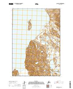
2019 Map of Ugashik C-2 NW
USGS Topo · Published 2019About this map
Upper Ugashik Lake dominates the northern reaches of this Alaskan landscape within the Lake and Peninsula Borough. The terrain is defined by a series of drainages, most notably Ugashik Cr flowing from the higher ground in the east. Further south, the map details the meandering paths of Crooked Cr and Deer Cr, which carve through the lowland areas. This 2019 survey documents a wilderness area defined by its hydrology, where the lack of human infrastructure highlights the importance of these named water bodies for navigation and survival. The map provides a precise record of the shoreline and elevation contours surrounding these vital freshwater sources in the Bristol Bay region.
Find a feature on this map
9 named features on this map. Tap any name to fly to it.
Don’t see what you’re looking for? This feature index may not catch every label — zoom into the map to look around manually.
Map Details
Editions of this 2019 Ugashik C-2 NW Map
This is the sole edition of this map. No revisions or reprints were ever made.
Other maps of this area

1943 · Ugashik
USGS Topo · 1:250,000

1948 · Ugashik
USGS Topo · 1:250,000

1949 · Ugashik
USGS Topo · 1:250,000

1951 · Ugashik C-2
USGS Topo · 1:63,360

1951 · Ugashik D-3
USGS Topo · 1:63,360

1951 · Ugashik C-3
USGS Topo · 1:63,360

1951 · Ugashik D-2
USGS Topo · 1:63,360

1963 · Ugashik
USGS Topo · 1:250,000
2019 · Ugashik C-2 SE
USGS Topo · 1:25,000
2019 · Ugashik D-3 SE
USGS Topo · 1:25,000