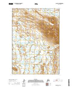
2019 Map of Ugashik C-3 NW
USGS Topo · Published 2019About this map
The low-lying wetlands and kettle lakes of the Alaska Peninsula dominate this landscape within the Lake and Peninsula Borough. Rising sharply above the surrounding marshy plains is Blue Mtn, a prominent topographic feature that provides a rare vertical anchor in a region otherwise defined by complex drainage patterns and scattered water bodies. The terrain illustrates the intricate glacial and hydrological history of the area, where subtle changes in elevation dictate the flow of water across the vast flats. This 2019 survey reflects the region's wilderness character, primarily organized by the Public Land Survey System grids such as t29s r47w and t28s r46w, showing a land largely untouched by traditional infrastructure or permanent settlements.
Find a feature on this map
6 named features on this map. Tap any name to fly to it.
Don’t see what you’re looking for? This feature index may not catch every label — zoom into the map to look around manually.
Map Details
Editions of this 2019 Ugashik C-3 NW Map
This is the sole edition of this map. No revisions or reprints were ever made.
Other maps of this area

1943 · Ugashik
USGS Topo · 1:250,000

1948 · Ugashik
USGS Topo · 1:250,000

1949 · Ugashik
USGS Topo · 1:250,000

1951 · Ugashik C-4
USGS Topo · 1:63,360

1951 · Ugashik D-3
USGS Topo · 1:63,360

1951 · Ugashik D-4
USGS Topo · 1:63,360

1951 · Ugashik C-3
USGS Topo · 1:63,360

1963 · Ugashik
USGS Topo · 1:250,000
2019 · Ugashik C-4 NE
USGS Topo · 1:25,000
2019 · Ugashik D-3 SE
USGS Topo · 1:25,000