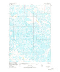
1951 Map of Ugashik C-4
USGS Topo · Published 1977About this map
The Ugashik River snakes through this water-saturated landscape, defining a complex network of wetlands and tundra just inland from the Alaska Peninsula coastline. In the early 1950s, this area remained largely inaccessible, evidenced by the scattered Cabin and Cabins sites that represent the only human footprint in an otherwise vast expanse of marsh. A single Footbridge provides a rare crossing point near the eastern edge of the survey, likely serving seasonal trappers or early surveyors navigating between the myriad unnamed ponds. The southeastern corner is dominated by the northern tip of Lower Ugashik Lake, while Andrew Creek drains the northern reaches. This map illustrates the raw hydrography of the region before significant modern development, preserving the locations of isolated structures used by those working the remote Seward Meridian.
Find a feature on this map
12 named features on this map. Tap any name to fly to it.
Don’t see what you’re looking for? This feature index may not catch every label — zoom into the map to look around manually.
Map Details
Editions of this 1951 Ugashik C-4 Map
2 editions found
Other maps of this area

1943 · Ugashik
USGS Topo · 1:250,000

1948 · Ugashik
USGS Topo · 1:250,000

1949 · Ugashik
USGS Topo · 1:250,000

1951 · Ugashik C-5
USGS Topo · 1:63,360

1951 · Ugashik C-4
USGS Topo · 1:63,360

1951 · Ugashik B-3
USGS Topo · 1:63,360

1951 · Ugashik D-5 and D-6
USGS Topo · 1:63,360

1951 · Ugashik D-3
USGS Topo · 1:63,360

1951 · Ugashik D-4
USGS Topo · 1:63,360

1951 · Ugashik C-3
USGS Topo · 1:63,360