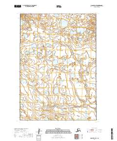
2019 Map of Ugashik D-3 SW
USGS Topo · Published 2019About this map
Wetland complexes and low-lying coastal terrain characterize this portion of the Lake and Peninsula Borough as documented in 2019. The landscape is primarily defined by the Public Land Survey System grids of T27s R47w, T27s R46w, T28s R47w, and T28s R46w. This specific region is notable for its intricate hydrography, consisting of dozens of unnamed lakes and interconnected ponds that dominate the northern and central sections of the quadrangle. The lack of named roads or established settlements reflects the wilderness character of the Alaska Peninsula, where the environment remains shaped by natural drainage patterns rather than human infrastructure. The survey provides a precise topographic record of this hydrologically active area, documenting the subtle elevation changes across a landscape where water and land are in constant flux.
Find a feature on this map
4 named features on this map. Tap any name to fly to it.
Don’t see what you’re looking for? This feature index may not catch every label — zoom into the map to look around manually.
Map Details
Editions of this 2019 Ugashik D-3 SW Map
This is the sole edition of this map. No revisions or reprints were ever made.
Other maps of this area

1943 · Ugashik
USGS Topo · 1:250,000

1948 · Ugashik
USGS Topo · 1:250,000

1949 · Ugashik
USGS Topo · 1:250,000

1951 · Ugashik C-4
USGS Topo · 1:63,360

1951 · Ugashik D-3
USGS Topo · 1:63,360

1951 · Ugashik D-4
USGS Topo · 1:63,360

1951 · Ugashik C-3
USGS Topo · 1:63,360

1963 · Ugashik
USGS Topo · 1:250,000
2019 · Ugashik C-4 NE
USGS Topo · 1:25,000
2019 · Ugashik D-3 NE
USGS Topo · 1:25,000