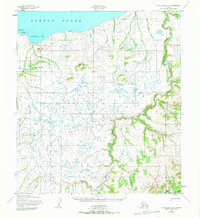
1952 Map of Unalakleet B-5
USGS Topo · Published 1965About this map
Klikitarik Bay and the coastline of Norton Sound define the northern edge of this Alaskan landscape, captured during a period of active reindeer husbandry and seasonal transit in the early 1950s. A notable Reindeer Corral stands near the shore, connected by a Winter Trail that weaves through the coastal lowlands before ascending into the highlands. The terrain is marked by prominent elevations such as Klikitarik Mountain and Tolukowuk Bluffs, which overlook a complex network of waterways including the Klikitarik River and the meandering Golsovia River. This survey offers insight into the subarctic environment's sparse but functional infrastructure, where geographic features like Oliver Hill and Tolk Hill served as vital landmarks for navigators and herders traversing the unorganized territory before statehood.
Find a feature on this map
16 named features on this map. Tap any name to fly to it.
Don’t see what you’re looking for? This feature index may not catch every label — zoom into the map to look around manually.
Map Details
Editions of this 1952 Unalakleet B-5 Map
2 editions found
Other maps of this area

1951 · Unalakleet
USGS Topo · 1:250,000

1952 · Unalakleet A-4
USGS Topo · 1:63,360

1952 · Unalakleet A-5
USGS Topo · 1:63,360

1952 · Unalakleet B-4
USGS Topo · 1:63,360

1952 · Unalakleet B-6
USGS Topo · 1:63,360

1952 · Unalakleet C-4
USGS Topo · 1:63,360

1952 · Unalakleet B-5
USGS Topo · 1:63,360
1952 · Unalakleet C-5
USGS Topo · 1:63,360

1952 · Unalakleet A-6
USGS Topo · 1:63,360

1952 · Unalakleet
USGS Topo · 1:250,000