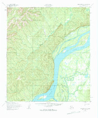
1952 Map of Unalakleet D-1
USGS Topo · Published 1963About this map
The Yukon River dominates this mid-century survey, carving a wide channel through the interior wilderness where intricate waterways like Steamboat Slough and Honeymoon Slough weave around large landmasses such as Quail Island. The landscape is defined by the tension between the massive river system and the high ground of the western bank, where the Eagle Slide marks a sharp transition in the terrain.
Find a feature on this map
9 named features on this map. Tap any name to fly to it.
Don’t see what you’re looking for? This feature index may not catch every label — zoom into the map to look around manually.
Map Details
Editions of this 1952 Unalakleet D-1 Map
2 editions found

Other maps of this area

1945 · Nulato
USGS Topo · 1:250,000

1948 · Norton Bay
USGS Topo · 1:250,000

1951 · Ophir
USGS Topo · 1:250,000

1951 · Nulato
USGS Topo · 1:250,000

1951 · Unalakleet
USGS Topo · 1:250,000

1951 · Norton Bay
USGS Topo · 1:250,000

1952 · Nulato
USGS Topo · 1:250,000

1952 · Nulato A-6
USGS Topo · 1:63,360

1952 · Unalakleet C-2
USGS Topo · 1:63,360

1952 · Unalakleet D-2
USGS Topo · 1:63,360