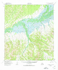
1950 Map of Unalakleet D-3
USGS Topo · Published 1974About this map
The Unalakleet River dominates this mid-century landscape, carving a wide, braided path through the Unalakleet D-3 quadrangle. This interior Alaskan terrain, mapped from 1950 aerial photography, reflects a remote region defined by its seasonal movement patterns and drainage networks. Significant travel corridors are marked by the Winter Trail and the Kaltab Portage, indicating the historical reliance on established routes across the watershed for transit between the coastal regions and the interior. The confluence of the main river with the Chiroskey River and smaller tributaries like Ten Creek and Rabbit Creek creates a complex wetland environment that has long served as a vital resource for local subsistence. High ground is punctuated by landmarks such as South River VABM 605, which provided a critical surveying benchmark in a territory otherwise characterized by unsurveyed and unmarked land lines.
Find a feature on this map
9 named features on this map. Tap any name to fly to it.
Don’t see what you’re looking for? This feature index may not catch every label — zoom into the map to look around manually.
Map Details
Editions of this 1950 Unalakleet D-3 Map
3 editions found
Other maps of this area

1948 · Norton Bay
USGS Topo · 1:250,000

1950 · Unalakleet D-3
USGS Topo · 1:63,360

1950 · Norton Bay A-4
USGS Topo · 1:63,360

1950 · Norton Bay A-3
USGS Topo · 1:63,360

1950 · Unalakleet D-4
USGS Topo · 1:63,360

1951 · Unalakleet
USGS Topo · 1:250,000

1951 · Norton Bay
USGS Topo · 1:250,000

1952 · Unalakleet C-2
USGS Topo · 1:63,360

1952 · Unalakleet D-2
USGS Topo · 1:63,360

1952 · Unalakleet C-3
USGS Topo · 1:63,360