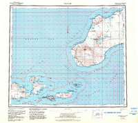
1951 Map of Unimak
USGS Topo · Published 1984About this map
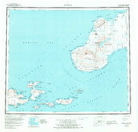
Akutan serves as the primary human footprint on this mid-century survey of the eastern Aleutian chain, situated where the Bering Sea meets the Pacific Ocean. The map documents a landscape dominated by volcanic activity and maritime necessity, featuring the massive Pogromni Volcano and the Fisher Caldera within the Unimak Wilderness. Crucial navigational aids for the treacherous North Pacific waters are noted, including the Scotch Cap Light, Akutan Pt Light, and the Cape Sarichef Lighthouse. The area's specialized infrastructure is visible through the Seaplane Anchorage at Akutan Harbor and a remote Landing Strip on Unimak. Beyond the volcanic peaks like Akutan Peak and Eichelberg Peak, the survey captures the complex coastline of islands such as Akun Island and Avatanak Island, marked by numerous bights, coves, and the geothermal presence at Hot Springs Bay.
Find a feature on this map
89 named features on this map. Tap any name to fly to it.
Don’t see what you’re looking for? This feature index may not catch every label — zoom into the map to look around manually.
Map Details
Editions of this 1951 Unimak Map
7 editions found
Other maps of this area

1943 · Fort Randall
USGS Topo · 1:250,000

1949 · False Pass
USGS Topo · 1:250,000

1949 · Fort Randall
USGS Topo · 1:250,000

1950 · False Pass
USGS Topo · 1:250,000

1950 · Fort Randall
USGS Topo · 1:250,000

1951 · Unalaska
USGS Topo · 1:250,000

1951 · Unimak
USGS Topo · 1:250,000

1958 · Unimak
USGS Topo · 1:250,000
1958 · Unimak B-2 NE
USGS Topo · 1:25,000

1989 · Unimak C-1
USGS Topo · 1:63,360