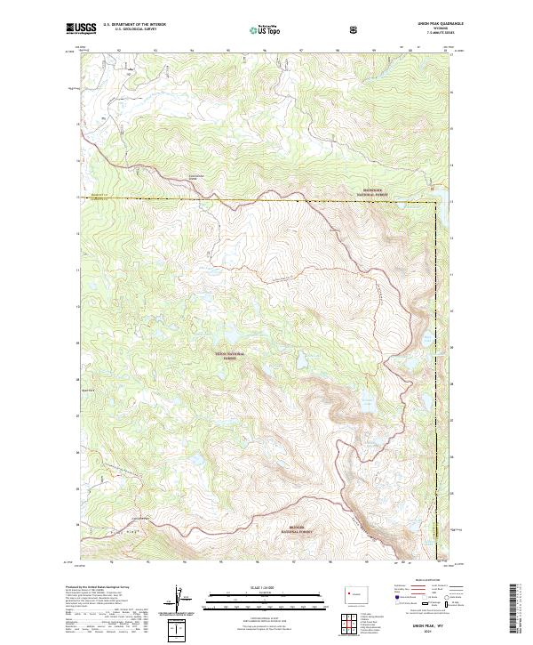
2021 Map of Union Peak
USGS Topo · Published 2021About this map
Continental Divide hydrology and high-altitude alpine basins define this 2021 survey of the Wind River Range. This region serves as a triple-point intersection for three major national forests: Shoshone National Forest, Teton National Forest, and Bridger National Forest. The map centers on the high summit of Union Peak and the nearby Union Pass, a historical corridor through the mountains. Dozens of alpine water bodies, including Seven Lakes, Union Lake, and Granite Lake, are scattered across the high plateau and drainage basins like S Fork Warm Spring Cr and S Fork Fish Cr. The map also traces the Continental Divide National Scenic Trl as it winds through the southern portion of the sheet near Gunsight Pass and Pinon Ridge, illustrating the modern recreational use of these remote mountain crests.
Find a feature on this map
46 named features on this map. Tap any name to fly to it.
Don’t see what you’re looking for? This feature index may not catch every label — zoom into the map to look around manually.
Map Details
Editions of this 2021 Union Peak Map
This is the sole edition of this map. No revisions or reprints were ever made.
Other maps of this area

1905 · Younts Peak
USGS Topo · 1:125,000

1907 · Younts Peak
USGS Topo · 1:125,000

1909 · Fremont Peak
USGS Topo · 1:125,000

1955 · Thermopolis
USGS Topo · 1:250,000

1956 · Dubois
USGS Topo · 1:24,000

1956 · Warm Spring Mountain
USGS Topo · 1:24,000

1956 · Fish Lake
USGS Topo · 1:24,000

1958 · Thermopolis
USGS Topo · 1:250,000

1962 · Thermopolis
USGS Topo · 1:250,000
1967 · Fish Creek Park
USGS Topo · 1:24,000