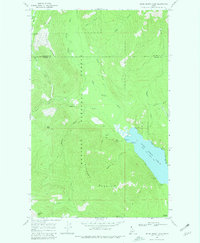
1969 Map of Upper Priest Lake
USGS Topo · Published 1981About this map
Upper Priest Lake and the surrounding reaches of the Kaniksu National Forest dominate this late-1960s landscape along the Boundary and Bonner County line. The map captures a high-elevation wilderness defined by steep ridges like Hughes Ridge and Plowboy Mountain, where human activity is limited to narrow infrastructure and resource extraction. Significant markers of forest management and early industry are evident at the Hughes Meadows Fire Station and its associated Lookout Tower, as well as the Mountain Chief Mine near Togo Gulch. A network of Pack Trails and Jeep Trails provides the only access through the dense drainage basins of Hughes Fork and Trapper Creek, illustrating the remote character of this North Idaho territory before modern recreational development intensified around the lake shore and Plowboy Campground.
Find a feature on this map
31 named features on this map. Tap any name to fly to it.
Don’t see what you’re looking for? This feature index may not catch every label — zoom into the map to look around manually.
Map Details
Editions of this 1969 Upper Priest Lake Map
4 editions found
Other maps of this area

1911 · Priest Lake
USGS Topo · 1:250,000

1913 · Priest Lake
USGS Topo · 1:250,000

1934 · Metaline
USGS Topo · 1:125,000

1942 · Metaline
USGS Topo · 1:125,000

1958 · Sandpoint
USGS Topo · 1:250,000

1963 · Sandpoint
USGS Topo · 1:250,000

1967 · Priest Lake NE
USGS Topo · 1:24,000

1967 · Salmo Mtn.
USGS Topo · 1:24,000

1967 · Priest Lake NW
USGS Topo · 1:24,000

1967 · Helmer Mtn
USGS Topo · 1:24,000