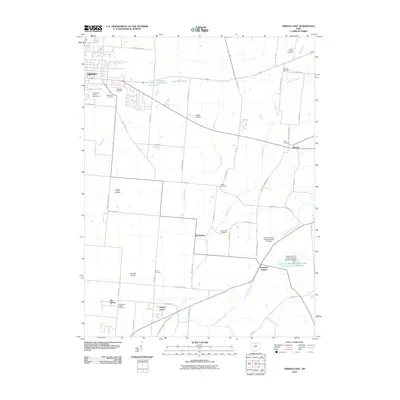
2010 Map of Urbana East
USGS Topo · Published 2010About this map
Urbana serves as the primary anchor for this landscape, where the eastern edge of the city transitions into the agricultural expanse of Champaign County. The area is defined by a dense network of local-history landmarks, particularly concentrated burial grounds such as Oakdale Cemetery, Grandview Cemetery, and Sharon Cemetery. Water management is a significant theme across the terrain, seen in the series of ponds northeast of the city center—First Price Pond, Second Price Pond, and Third Price Pond—as well as the engineered structures along Buck Creek. These include the East Fork Buck Creek Structure Number Four Reservoir and associated dams, which suggest a late 20th-century focus on flood control and water resources. Smaller rural communities and residential clusters like Mutual, Powhattan, and Plateau Acres are connected by a grid of named roads, while the presence of Weller Airport and Berryhill Airport highlights the region's relationship with private aviation and localized transport.
Find a feature on this map
63 named features on this map. Tap any name to fly to it.
Don’t see what you’re looking for? This feature index may not catch every label — zoom into the map to look around manually.
Map Details
Editions of this 2010 Urbana East Map
This is the sole edition of this map. No revisions or reprints were ever made.
Other maps of this area

1904 · Springfield
USGS Topo · 1:62,500

1906 · Springfield
USGS Topo · 1:62,500

1907 · South Charleston
USGS Topo · 1:62,500

1914 · St. Paris
USGS Topo · 1:62,500

1914 · Mechanicsburg
USGS Topo · 1:62,500

1916 · Mechanicsburg
USGS Topo · 1:62,500

1916 · St. Paris
USGS Topo · 1:62,500

1944 · Mechanicsburg
USGS Topo · 1:62,500

1944 · St. Paris
USGS Topo · 1:62,500

1947 · Columbus
USGS Topo · 1:250,000