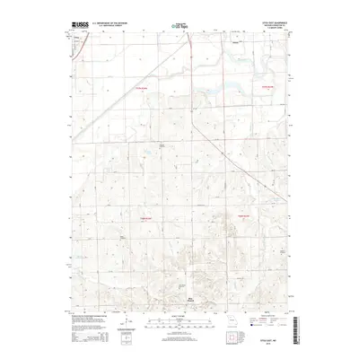
2015 Map of Utica East
USGS Topo · Published 2015About this map
Blue Mound rises as a prominent landmark in this section of Livingston County, overlooking a landscape defined by the meandering Grand River and its complex network of tributaries. The terrain transitions from the river bottomlands near Shoal Creek and Wolf Creek to the undulating uplands where numerous family and community landmarks are found. For genealogists, the placement of the Christian Cemetery, Welsh Cemetery, Blue Mound Cemetery, and Mayberry Cemetery provides essential context for 21st-century family history research. Small settlements such as Utica and Cleary anchor the rural infrastructure, connected by a grid of county roads and state routes like Mo-C. The presence of several small water bodies, including Roach Lake, Englert Lake, and Melvin Watkins Lake, suggests a landscape shaped by both natural drainage and local land management.
Find a feature on this map
28 named features on this map. Tap any name to fly to it.
Don’t see what you’re looking for? This feature index may not catch every label — zoom into the map to look around manually.
Map Details
Editions of this 2015 Utica East Map
This is the sole edition of this map. No revisions or reprints were ever made.
Other maps of this area

1921 · Chillicothe
USGS Topo · 1:62,500

1923 · Chillicothe
USGS Topo · 1:62,500

1924 · Dawn
USGS Topo · 1:62,500

1924 · Chula
USGS Topo · 1:62,500

1924 · Hale
USGS Topo · 1:62,500

1947 · Chula
USGS Topo · 1:62,500

1950 · Coloma
USGS Topo · 1:24,000

1950 · Plymouth
USGS Topo · 1:24,000

1951 · Utica
USGS Topo · 1:62,500

1951 · Hale
USGS Topo · 1:62,500