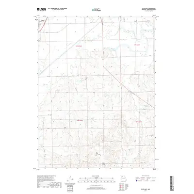
2017 Map of Utica East
USGS Topo · Published 2017About this map
Blue Mound rises as a prominent landmark in the southern reaches of this landscape, surrounded by a network of rural cemeteries that speak to the long-standing family settlements of Livingston County. Small burial grounds like Blue Mound Cem, Welsh Cem, and Christian Cem are scattered across the rolling hills between the drainages of Shoal Creek and the Grand River. In the northwest corner, the village of Utica sits near the confluence of local waterways, while several small reservoirs such as Englert Lake and Monohame Lake are tucked into the drainages of Brush Cr and Wolf Grove Cr. The map details a transition from the wider river bottoms of Wolf Cr and Shoal Cr in the north to the more dissected upland terrain toward the south, providing a clear record of the intersection between established homesteads and the natural drainage patterns of the Missouri interior.
Find a feature on this map
28 named features on this map. Tap any name to fly to it.
Don’t see what you’re looking for? This feature index may not catch every label — zoom into the map to look around manually.
Map Details
Editions of this 2017 Utica East Map
This is the sole edition of this map. No revisions or reprints were ever made.
Other maps of this area

1921 · Chillicothe
USGS Topo · 1:62,500

1923 · Chillicothe
USGS Topo · 1:62,500

1924 · Dawn
USGS Topo · 1:62,500

1924 · Chula
USGS Topo · 1:62,500

1924 · Hale
USGS Topo · 1:62,500

1947 · Chula
USGS Topo · 1:62,500

1950 · Coloma
USGS Topo · 1:24,000

1950 · Plymouth
USGS Topo · 1:24,000

1951 · Utica
USGS Topo · 1:62,500

1951 · Hale
USGS Topo · 1:62,500