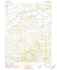
1984 Map of Utica East
USGS Topo · Published 1984About this map
The Grand River and its intricate network of levees dominate this northern Missouri landscape, bordering the southwestern edge of Chillicothe. This 1980s-era survey reveals a river valley defined by extensive flood control and a patchwork of riparian terrain, including Roach Lake and the winding Leeper Branch. To the west, the settlement of Utica sits near the confluence of major tributaries like Shoal Creek and Wolf Creek.
Find a feature on this map
18 named features on this map. Tap any name to fly to it.
Don’t see what you’re looking for? This feature index may not catch every label — zoom into the map to look around manually.
Map Details
Editions of this 1984 Utica East Map
This is the sole edition of this map. No revisions or reprints were ever made.
Other maps of this area

1921 · Chillicothe
USGS Topo · 1:62,500

1923 · Chillicothe
USGS Topo · 1:62,500

1924 · Dawn
USGS Topo · 1:62,500

1924 · Chula
USGS Topo · 1:62,500

1924 · Hale
USGS Topo · 1:62,500

1947 · Chula
USGS Topo · 1:62,500

1950 · Coloma
USGS Topo · 1:24,000

1950 · Plymouth
USGS Topo · 1:24,000

1951 · Utica
USGS Topo · 1:62,500

1951 · Hale
USGS Topo · 1:62,500