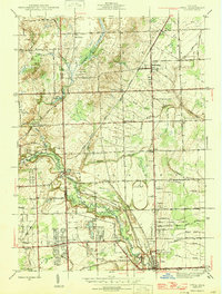
1946 Map of Utica
USGS Topo · Published 1946About this map
The Middle Branch Clinton River carves through the heart of Macomb County in the mid-1940s, defining a landscape of established townships like Shelby and Washington. The village of Utica serves as a local hub, surrounded by a network of drainage features such as the Banister Drain and the Michigan Central Canal, which reflect the region's managed agricultural and industrial water use. The map illustrates a transitional period where rural schoolhouses like Avon Sch and Plain Sch still dot the countryside alongside leisure developments like the Mt Vernon Golf and Country Club. For genealogists, the proximity of family-named landmarks and cemeteries, including Curtis Cem and Prestonville Cem, provides a specific record of the families settled near the Oakland and Macomb county line.
Find a feature on this map
52 named features on this map. Tap any name to fly to it.
Don’t see what you’re looking for? This feature index may not catch every label — zoom into the map to look around manually.
Map Details
Editions of this 1946 Utica Map
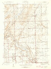
2 editions found
Other maps of this area

1908 · Rochester
USGS Topo · 1:62,500

1912 · Mt Clemens
USGS Topo · 1:62,500

1914 · Armada
USGS Topo · 1:62,500

1928 · Armada
USGS Topo · 1:62,500

1929 · Mt Clemens
USGS Topo · 1:62,500

1936 · Warren
USGS Topo · 1:31,680

1936 · Birmingham
USGS Topo · 1:31,680

1936 · Rochester
USGS Topo · 1:31,680

1936 · Washington
USGS Topo · 1:31,680

1936 · Waldenburg
USGS Topo · 1:31,680
Featured Places
- Sterling Heights, MI
- Shelby Charter Township, MI
- Rochester Hills, MI
- Washington Charter Township, MI
- Oakland Charter Township, MI