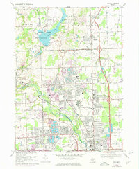
1968 Map of Utica
USGS Topo · Published 1974About this map
The Clinton River and its various tributaries, including the Middle Branch Clinton River and Shooke Drain, anchor this landscape as it transitions into suburban development. Centered on Stony Creek Metropolitan Park, the map captures the extensive water resources and picnic areas surrounding Stony Creek, while further south, the Rochester-Utica State Recreation Area follows the river's bend toward the settlement of Utica. Industrial and military history is evident in the large Proving Ground located east of the river and the presence of numerous gravel pits scattered across the township lines.
Find a feature on this map
76 named features on this map. Tap any name to fly to it.
Don’t see what you’re looking for? This feature index may not catch every label — zoom into the map to look around manually.
Map Details
Editions of this 1968 Utica Map
4 editions found
Other maps of this area

1908 · Rochester
USGS Topo · 1:62,500

1912 · Mt Clemens
USGS Topo · 1:62,500

1914 · Armada
USGS Topo · 1:62,500

1928 · Armada
USGS Topo · 1:62,500

1929 · Mt Clemens
USGS Topo · 1:62,500

1936 · Warren
USGS Topo · 1:31,680

1936 · Birmingham
USGS Topo · 1:31,680

1936 · Rochester
USGS Topo · 1:31,680

1936 · Washington
USGS Topo · 1:31,680

1936 · Waldenburg
USGS Topo · 1:31,680
Featured Places
- Sterling Heights, MI
- Shelby Charter Township, MI
- Rochester Hills, MI
- Washington Charter Township, MI
- Oakland Charter Township, MI