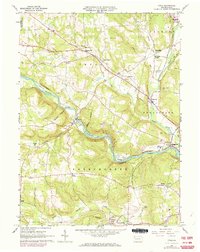
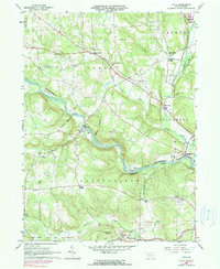
1963 Map of Utica
USGS Topo · Published 1973About this map
French Creek carves a winding path through this corner of Venango County, serving as the central geographic feature for settlements like Utica and Takitezy. The landscape is defined by the intersection of water and rail, with the Erie-Lackawanna and Penn Central railroads following the river valleys and creek beds. In the north, Cooperstown and Hannasville sit near the Crawford County line, while Polk occupies the southern edge along the winding Little Sandy Creek.
Find a feature on this map
55 named features on this map. Tap any name to fly to it.
Don’t see what you’re looking for? This feature index may not catch every label — zoom into the map to look around manually.
Map Details
Editions of this 1963 Utica Map
5 editions found
Other maps of this area

1909 · Franklin
USGS Topo · 1:62,500

1911 · Franklin
USGS Topo · 1:62,500

1911 · Stoneboro
USGS Topo · 1:62,500

1913 · Stoneboro
USGS Topo · 1:62,500

1923 · Meadville
USGS Topo · 1:62,500

1925 · Meadville
USGS Topo · 1:62,500

1927 · Townville
USGS Topo · 1:48,000

1932 · Townville
USGS Topo · 1:62,500

1943 · Meadville
USGS Topo · 1:62,500

1943 · Stoneboro
USGS Topo · 1:62,500