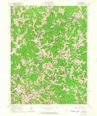
1964 Map of Vadis
USGS Topo · Published 1966About this map
The Gas and Oil Field defines the industrial footprint of this mid-1960s landscape, where dozens of well sites and multiple compressor stations dot the valleys of Fink Creek and Leading Creek. This intersection of the Cove, Freemans Creek, and Courthouse districts reveals a landscape of high ridges and narrow creek bottoms. Small community centers such as Alum Bridge, Hurst, and Leopold serve as anchors for the local population, while the network of gas and oil infrastructure indicates a heavy reliance on mineral extraction during this era. Rural life is well-documented through numerous ecclesiastical sites including St Marys Cath Ch, Point Pleasant Ch, and St Boniface Ch, along with family-named landmarks like the Halderman Cem and Farnsworth Cem.
Find a feature on this map
50 named features on this map. Tap any name to fly to it.
Don’t see what you’re looking for? This feature index may not catch every label — zoom into the map to look around manually.
Map Details
Editions of this 1964 Vadis Map
2 editions found
Other maps of this area

1893 · Sutton
USGS Topo · 1:125,000

1904 · Vadis
USGS Topo · 1:62,500

1906 · Holbrook
USGS Topo · 1:62,500

1906 · Glenville
USGS Topo · 1:62,500

1906 · Burnsville
USGS Topo · 1:62,500

1924 · Holbrook
USGS Topo · 1:62,500

1925 · Glenville
USGS Topo · 1:62,500

1925 · Burnsville
USGS Topo · 1:62,500

1925 · Vadis
USGS Topo · 1:62,500

1926 · Holbrook
USGS Topo · 1:62,500