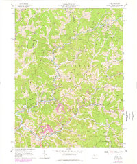
1964 Map of Vadis
USGS Topo · Published 1977About this map
Vadis sits at the heart of this detailed topographic study, which captures the rural character of the West Virginia hills during the mid-1960s with updates from 1976. The landscape is defined by the intersection of Doddridge, Gilmer, and Lewis counties, where narrow valleys and winding watercourses like Fink Creek and Leading Creek dictate the pattern of settlement. The area is heavily marked by the Gas and Oil Field, with numerous wells and a Compressor Station scattered throughout the hillsides, illustrating the importance of energy extraction to the local economy.
Find a feature on this map
59 named features on this map. Tap any name to fly to it.
Don’t see what you’re looking for? This feature index may not catch every label — zoom into the map to look around manually.
Map Details
Editions of this 1964 Vadis Map
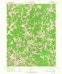
2 editions found
Other maps of this area

1893 · Sutton
USGS Topo · 1:125,000

1904 · Vadis
USGS Topo · 1:62,500

1906 · Holbrook
USGS Topo · 1:62,500

1906 · Glenville
USGS Topo · 1:62,500

1906 · Burnsville
USGS Topo · 1:62,500

1924 · Holbrook
USGS Topo · 1:62,500

1925 · Glenville
USGS Topo · 1:62,500

1925 · Burnsville
USGS Topo · 1:62,500

1925 · Vadis
USGS Topo · 1:62,500

1926 · Holbrook
USGS Topo · 1:62,500