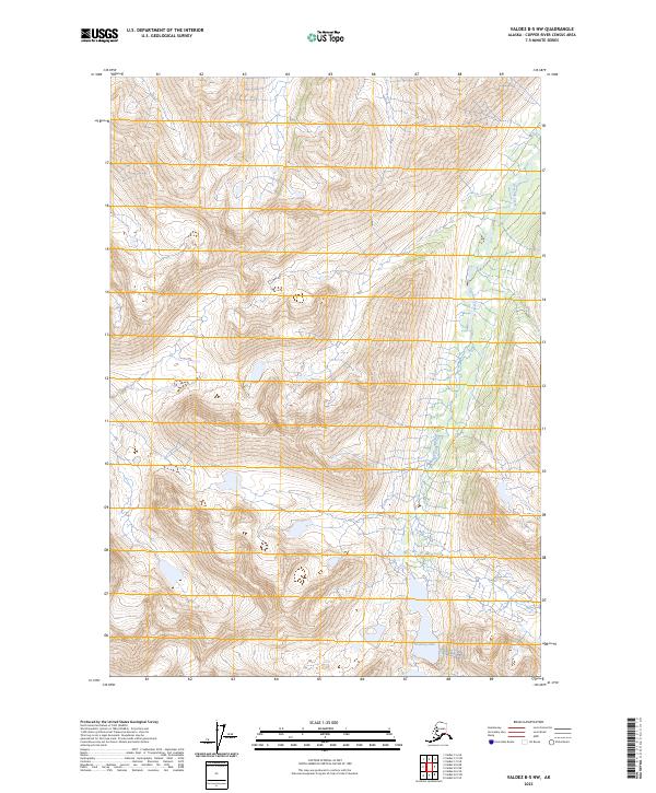
2023 Map of Valdez B-5 NW
USGS Topo · Published 2023About this map
Greyling Lake and its surrounding watershed define this high-altitude landscape in the Copper River region. The terrain is characterized by steep elevation changes and a complex drainage network where Greyling Creek flows through the eastern valleys. Surveyed into several townships including t5s r3w and t4s r3w, the area remains largely undeveloped, showing no major roads or permanent settlements. The contour intervals illustrate a high mountain environment dominated by glacial-carved valleys and seasonal runoff channels. This 2023 edition provides a precise view of the hydrology and topographic relief of this interior Alaskan wilderness, serving as a reliable baseline for studying the remote headwaters of the region's larger river systems.
Find a feature on this map
8 named features on this map. Tap any name to fly to it.
Don’t see what you’re looking for? This feature index may not catch every label — zoom into the map to look around manually.
Map Details
Editions of this 2023 Valdez B-5 NW Map
This is the sole edition of this map. No revisions or reprints were ever made.
Other maps of this area

1950 · Valdez C-6
USGS Topo · 1:63,360

1951 · Valdez B-5
USGS Topo · 1:63,360

1951 · Valdez C-5
USGS Topo · 1:63,360

1951 · Valdez B-6
USGS Topo · 1:63,360

1952 · Valdez
USGS Topo · 1:250,000

1953 · Valdez C-6
USGS Topo · 1:63,360

1953 · Valdez C-5
USGS Topo · 1:63,360

1953 · Valdez B-6
USGS Topo · 1:63,360

1960 · Valdez
USGS Topo · 1:250,000
1993 · Valdez C-6
USGS Topo · 1:63,360