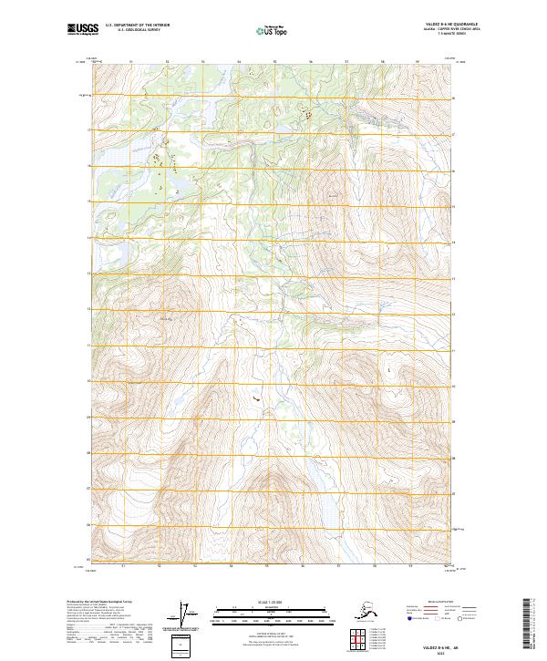
2023 Map of Valdez B-6 NE
USGS Topo · Published 2023About this map
Klutina River flows through this high-altitude landscape of the Copper River Census Area, carving a path through terrain defined by significant peaks. The elevation rises sharply toward several named summits, including Black Mtn in the north and the prominent Sharp Peak and Camp Mtn further south. This 2023 edition highlights a region largely devoid of permanent human infrastructure, focusing instead on the hydrography of Stephens Creek and the natural drainages of the Klutina River valley. The map provides a detailed record of the physical geography and township boundaries, including t5s r4w and t5s r5w, reflecting the vast, uninhabited character of this Alaskan interior.
Find a feature on this map
11 named features on this map. Tap any name to fly to it.
Don’t see what you’re looking for? This feature index may not catch every label — zoom into the map to look around manually.
Map Details
Editions of this 2023 Valdez B-6 NE Map
This is the sole edition of this map. No revisions or reprints were ever made.
Other maps of this area

1950 · Valdez C-6
USGS Topo · 1:63,360

1951 · Valdez B-5
USGS Topo · 1:63,360

1951 · Valdez C-5
USGS Topo · 1:63,360

1951 · Valdez B-6
USGS Topo · 1:63,360

1952 · Valdez
USGS Topo · 1:250,000

1953 · Valdez C-6
USGS Topo · 1:63,360

1953 · Valdez C-5
USGS Topo · 1:63,360

1953 · Valdez B-6
USGS Topo · 1:63,360

1960 · Valdez
USGS Topo · 1:250,000
1993 · Valdez C-6
USGS Topo · 1:63,360